
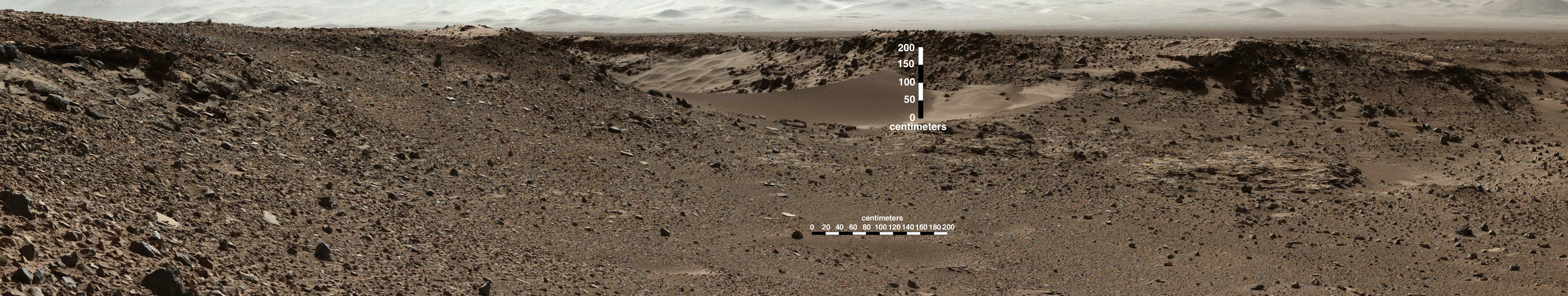
This scene combines images taken by the left-eye camera of the Mast Camera (Mastcam) instrument on NASA's Curiosity Mars rover during the mid-afternoon, local Mars solar time, of the mission's 526th Martian day, or sol (January 28, 2014). The sand dune in the upper center of the image spans a gap, called "Dingo Gap," between two short scarps. The dune is about 3 feet (1 meter) high. The nearer edge of it is about 115 feet (35 meters) away from the rover's position when the component images were taken, just after a Sol 526 drive of 49 feet (15 meters).
The image has been white-balanced to show what the rocks would look like if they were on Earth. A version with 200-centimeter (79-inch) scale bars is available as Figure A. A version with raw color, as recorded by the camera under Martian lighting conditions, is available as Figure B.
Image credit: NASA/JPL-Caltech/MSSS
Note: For more information, see PIA17763: Full-Circle Vista During Curiosity's Approach to 'Dingo Gap', PIA17764: Full-Circle Vista During Curiosity's Approach to 'Dingo Gap' (Stereo), PIA17765: Traverse Map for Mars Rover Curiosity as of January 26, 2014, PIA17767: Crystal-Laden Martian Rock Examined by Curiosity's Laser Instrument and Curiosity Mars Rover Checking Possible Smoother Route.
No comments:
Post a Comment