
The banding in this image has been interpreted based on MOC images to be layering. A critical goal of this observation is to provide points of comparison with HiRISE full resolution coverage and CRISM infrared spectra of light-toned rock outcrops in other areas of the Mawrth Vallis region.
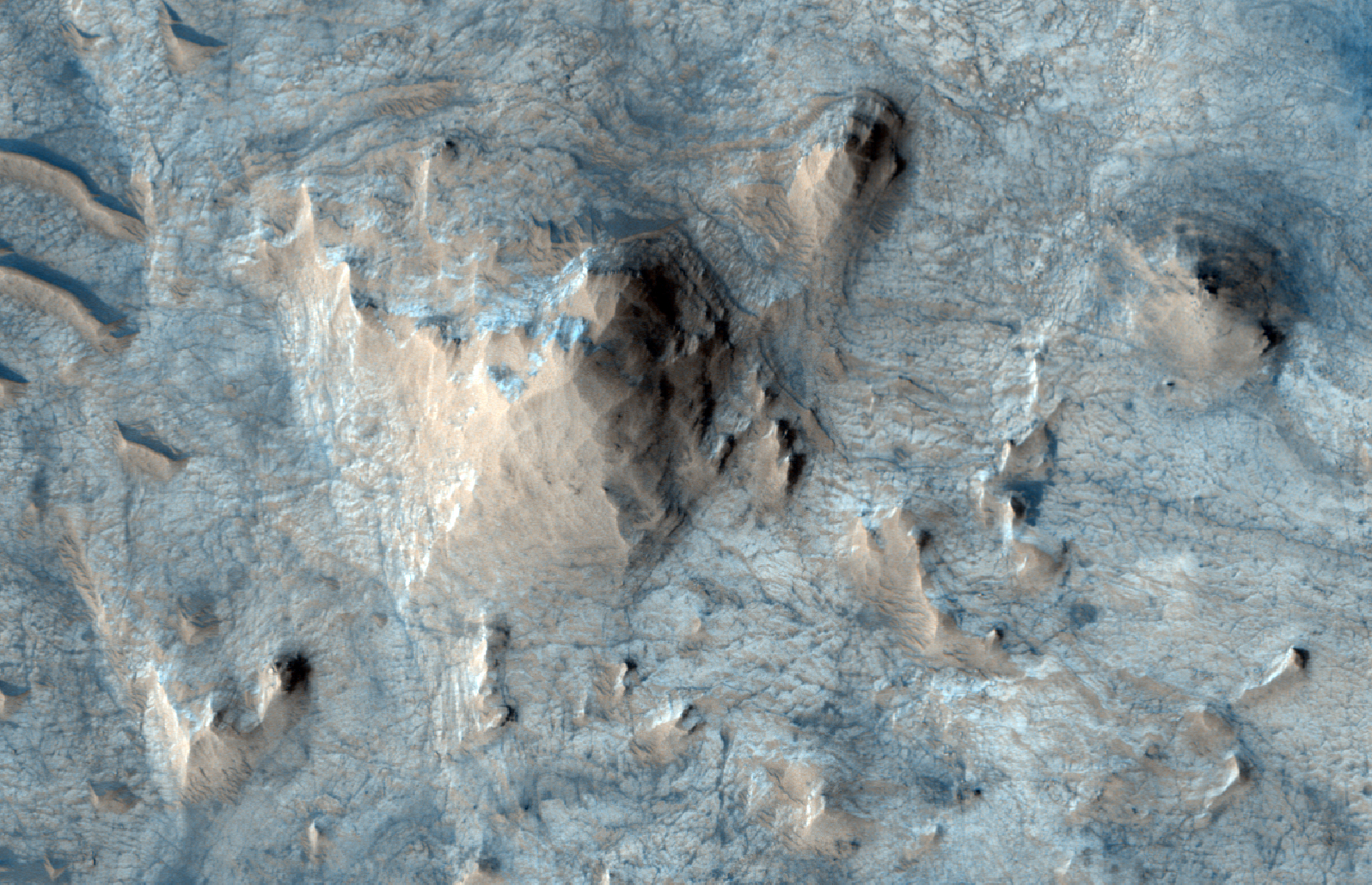
The dark terrain at the north end of the image is heavily cratered and has thus been there (at the surface) longer than the brighter terrain in the rest of the image. But is it older, as heavily cratered terrain often indicates?
The dark terrain appears to be higher in elevation, which in layered terrain usually means that it is actually younger than the bright terrain (lower layers are deposited first). One possibility is that the bright terrain used to be covered with the darker material also, but that that darker material has been stripped off and removed, revealing the brighter layers and terrain below. If this is indeed the case, then the low bright terrain could actually be older and it has fewer craters only because it has been more recently exposed to the surface. Clues to this are small high-standing knobs throughout the bright terrain that could be remnants of once more-widespread higher topography.
Also, the larger circular to oval patches, or "islands" of smooth dark material within the bright material are also high-standing. They may be old impact craters, exterior to which erosion has removed dark terrain, but interior to which the crater walls or some hardening process has protected the dark terrain from erosion. Such terrain is called "inverted topography" because a crater depression which was once empty and low has become filled, and the material outside of the crater has been removed while the material inside the crater hasn't - producing relief opposite to that of the original landscape.
Photo credit: NASA/JPL/University of Arizona
No comments:
Post a Comment